Feeds:
Posts
Comments

Archive for the ‘Hiking’ Category

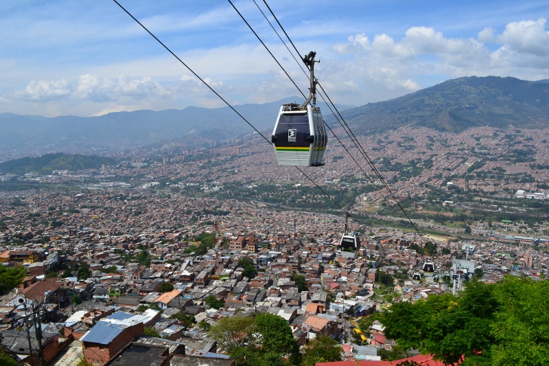
After nearly four months in South America, our time here is drawing to an end. We chose to spend our final weeks enjoying Colombia’s Caribbean Coast. We booked a flight from Cali to Santa Marta with the aim of exploring Tayrona National Park.

Unfortunately for us, our flight that was supposed to arrive up north just after 9pm was three hours delayed. For most people that travel regularly in the US, a three hour delay is fairly routine, annoying yes, but not a big deal. Apparently, this is not the case in Colombia. The flight delay turned into quite an ordeal. First, the captain came out to the gate to personally announce the delay and explain the reason; a flight attendant had fallen ill and could not make the return flight. The crowd exploded in an angry roar; from that point on, it was impossible to hear any of the announcements being made about the delay. Can you imagine an airline providing a reason for a delay other than “technical issues”?! Every time an airline official tried to take the microphone, the complaints from the crowd got louder. Then, our luck changed. Our delayed flight turned into some free food. To try and calm things down, the airline decided to give out sandwiches and juice. After 14 months of traveling, we will take any free meal we can get!

When we finally did arrive in Santa Marta, it was after midnight and there were only a few taxis still lingering around at the airport, so we had to share with a stranger. The driver told us, “no problem, I just need to drop this guy off in a neighborhood nearby.” What he didn’t tell us until we were already on the road was that the neighborhood is the ghetto of Santa Marta. As we drove further into the barrio, the driver slowed down to ask some rough looking guys for directions. This is when we both thought, “Great, almost done with Colombia and now we are going to get robbed in the classic taxi scam that we have heard so much about.” But oh, ye of little faith, we were wrong and thirty minutes later were finally safe and sound at our hostel and ready for some sleep.

The next day was spent gearing up for our Tayrona camping trip. Canned tuna, fruits & vegetables, 18 liters of water, bug spray and a bottle of rum all made the shopping list. It wasn’t until we got back to the hostel and started packing up that we learned some dreadful news: bringing alcoholic beverages into Tayrona National Park is prohibited…nooooooo! But being the optimists that we are, we decided that there are worse things in life than being in the Caribbean with a bottle of rum that needs to be consumed in an expedient fashion. The next morning, we fought through some mental fog and made our way by bus to Tayrona National Park.

Tayrona National Park

Getting into the park itself proved to be a bit of a process. First, they search your bags for plastic and styrofoam, neither of which are allowed inside. Next, you go through a police check point where you get questioned and searched again, this time for drugs, weapons and alcohol. Once you’ve made it through both of these steps, then they let you fork over the 38,000 Pesos for the entrance ticket; a colorful wrist band gets slapped around your hand and off you go to hike to the beach. The walk itself was beautiful; it cuts through the dense jungle, in and out of coconut groves, up to viewpoints of the ocean and finally onto the sandy white beach, however, it was a very sweaty and exhausting journey and we were glad to find a place to camp at the end of the trail.

Camping Tayrona

When we departed Santa Marta for Tayrona, we didn’t know how long we would stay, but the tranquil beaches and awesome camping spot made us want to hang around a little longer. There isn’t much more to do in Tayrona other than lounge on the beach and hike, and that was plenty enough for us. Both are right up our alley. Part of the beauty of Tayrona is that each beach is its own cove, all of which are strung together by footpaths through the jungle. Every day we explored a new spot.

Beaches of Tayrona

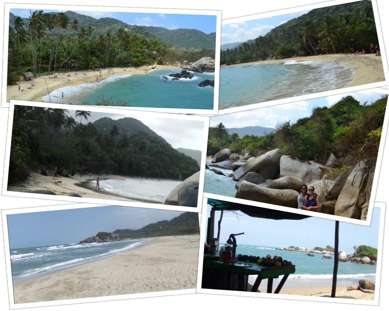
While many campers choose to set-up  near the beaches, we opted for something less crowded, more laid back, and a lot more affordable. We found a campsite nestled in the jungle about 10 minutes walking from the sea. Being away from the water meant longer hikes every day to the beaches and archeological sites in the park, but we didn’t mind one bit. Even at that distance from the water, Tayrona is so remote that we could still hear the crashing waves from our tent at night, and during our daily treks we crossed paths with some of the craziest ants we have ever seen! Countless ant super-highways were strewn about the jungle.

Hiking in Tayrona

Eventually our food and water ran out, and while we would have liked to stay longer, we decided to hit the road and head west towards Cartagena and Playa Blanca, another rustic beachfront locale. With our days in Colombia numbered, we think back frequently on a slogan we heard when we first arrived in Bogota: “Colombia – the greatest risk is that you won’t want to leave.”

Advertisement

Read Full Post »

We couldn’t help but to extend our days in Salento. It is like summer camp for adults. At the beginning of our stay, we had reserved only three nights, and then we added a few more, and then a few more, and before we knew it, we’d been there for more than a week. It is the perfect place to slow down and relax. If it weren’t for the flight we’d booked from Cali to the northern coast of Colombia, we may have stayed forever.

Hiking, coffee fincas, mystical clouds swirling around the green hills, great meals with great people, hammocks, games of tejo, delicious trucha con patacones, rainy days, campfires, fireflies, card games, movie nights & popcorn, humming birds, wax palms, hot springs…what is more to love?

We were lucky to catch this view of the Cocora Valley from the mirador in Salento, as clear days are few and far between.

We don’t normally advertise the places we stay on our blog, but La Serrana Eco Farm & Hostel was a big part of the reason that we chose to slow down our travel pace and just soak it all in. It is about a 20 minute walk from the town center and provide peace and serenity, especially on foggy mornings like this. We truly enjoyed our quiet walks through the country side.  To be clear, La Serrana offered us nothing to mention their name, we just loved the place.

Hiking through el Valle de Cocora is likely Salento’s biggest tourist activity. These towering wax palm trees cover the valley floor and are stunningly beautiful.

After hours hiking, we stopped at a humming bird sanctuary, which was really more of a rustic lodge run by an elderly couple. Who said humming birds can’t be captured mid-wing flap? One Croatian traveler hiking the trail with us said it couldn’t be done without a tripod and special camera. Mike begged to differ and got this shot in just a matter of minutes.

Divine chocolate caliente con queso served at the humming bird sanctuary.

As we descended back down the trail and out of the fog, we found ourselves once again surrounded by wax palms reaching towards the sky.

Have you ever had avacado flan? We hadn’t either before the incredible 8-course tasting menu prepared for us by Chef Michael Neff, a fellow guest at our hostel in Salento. Communal meals in the dinning hall added to the summer camp feel.

Hot springs Colombian style: pumping music, back flips, party time. Not exactly the relaxing day that we had envisioned for ourselves, but enjoyable nonetheless.

This chicken bus to the termales in Santa Rosa de Cabal made our day! Riding this bus turned out to be better than the hot springs themselves. The salsa music was blaring, and the driver slowed down to holler at every señorita in town.

The weather in Salento seemed to rotate between rain and shine. We took advantage of the sun one day to hike down to a nearby coffee finca. With views like this all around, you can imagine why we chose to stay for a while.

We took a tour of Don Elias’s coffee finca not far from our hostel. When these arabica beans are bright red, they are ripe and ready to pick.

Don Elias and his family run a very small operation.  This peeler is the only one they use to remove the skins from all of their beans. Our tour guide, Juan, walked us through the entire process from planting the crop to brewing a cup. It was some of the best coffee we have ever tasted.

One last look at our misty retreat, La Serrana, and the loyal house dog, Pablo.

Read Full Post »

When we asked our friend, Andres, about his home country of Colombia, he gave us numerous suggestions, but he was insistent about one thing. He told us, “visit Medellín, the jewel amazing.” It turned into a bit of a joke for us; we suppose he meant “the amazing jewel” and just put the adjective after the noun as is often done in Spanish, but with every spectacular view of the city we got last week, we told ourselves, “oh yes, Medellín, the jewel amazing!”

And what an amazing place it was indeed. As Colombia’s third largest city, Medellín is home to millions. It has many of the things that you might expect to find in a big city: high-rises, freeways, airport, museums, and a truly world-class metro system. What makes Medellín so special, however, is its location amongst lush green mountains.

Metrocable gondola in Medellin

We spent our few days in Medellín seeking out the best spots for taking in views of the city from the surrounding mountains and hills. First up was the Line K Metrocable, a gondola that serves as public transportation for people that live in the hilly barrio of Santo Domingo at the northeastern end of the city. The views are incredible on a clear day and the price can’t be beat. Since the metrocable is integrated with Medellín’s metro system, for less than $1 USD you can go from any metro stop in the city up the gondola to la Biblioteca España.

Metrocable Medellin

For only a few dollars more, you can transfer to the Line L gondola, which takes you to the brand new nature preserve called Parque Arví. At first, we thought that the park was just a few hundred meters further up the mountain, but as it reached the top, we saw a massive expanse of green forest in front of us and a gondola line that stretched for kilometers. Riding Line L felt like flying over the wilderness. It really made us miss skiing in the mountains of Colorado and was a very welcomed surprise. What a cool way to connect the bustling city of Medellín with the tranquil nature that surrounds it!

Parque Arvi Medellin

Another fantastic place to see 360˚ views of the jewel amazing is Cerro El Volador. Its location along the main road of Carrera 70 makes it easy to access, and its proximity to the central business area provides especially nice views of the mountains with the cityscape in the foreground. The walk up is steep, but definitely worth it, and the benches at the summit are the perfect place to take a long rest. We found El Volador much more beautiful than the famous Cerro Nutibara where Pueblito Paisa is located, a touristy recreation of an old colonial village.

Cerro Volador Medellin

There are no doubt countless other places to absorb the mountains views of Medellín, and hopefully on our next visit to Colombia we will explore a few more. But for now, we are recommending Cerro El Volador and the Line K Metrocable.

Read Full Post »

Take a moment to construct this in your mind: white-washed buildings, cobbled streets, tile roofs, wooden balconies and bright flowers peaking over walled courtyards. The image you have just formed probably looks a lot like a typical colonial town in Colombia. Villa de Leyva was the first such village we visited that fit this profile. It was declared a National Monument in order to protect its colonial architecture, and its proximity to Bogotá make it Colombia’s premier destination for reliving the country’s colonial past.

Colonial Colombia

The town’s main plaza is a vast expanse of cobblestones and is claimed to be the largest such plaza in South America. It is the heart of Villa de Leyva and where all the action takes place. Granted, it’s not much action, as the town is home to less than 10,000 people, but the square does come alive during the night time. Locals and tourists alike grab beers from one of the many convenience stores that line the plaza and take a seat on the cathedral steps, a bench or plastic chairs and talk the night away.

Villa de Leyva Square

In rural communities across the world, farmer’s markets are a tradition that date back centuries. Luckily, we visited Villa de Leyva on a weekend, so were able to experience the weekly Saturday market that takes place just a few blocks away from the plaza mayor. It was the best we’ve seen in this part of the world, but we can’t exactly pinpoint why. It certainly wasn’t the largest, and it wasn’t particularly exciting, but there was just something about it. Maybe it was the old man that sells soft-serve ice cream with sprinkles out of the back of his pick-up truck, or maybe the endless supply of huge and juicy mangos. It also very well could have been the stands that sell freshly grilled meats and perfectly fried plantains, or possibly the old, grey-haired cowboys knocking back round after round of cervezas. Regardless, it is not to be missed on your visit to Villa de Leyva.

Villa de Leyva Saturday Market

If you leave Villa de Leyva early, you can reach the town of Barichara in the same day. Much smaller than Villa de Leyva, and nestled amongst green mountains, it is said to be the most beautiful town in all of Colombia. This was the second stop on our quest to soak up the country’s colonial architecture. One person described Barichara as Villa de Leyva’s little brother, and we could see why. It has many of the same design features on the surface, but to us it has a bit more charm and quaintness than Villa de Leyva.

Barichara

From Barichara, we followed in the footsteps of South America’s most famous figure, “El Libertador” Simon Bolivar, and hiked the now famous Camino Real trail between Barichara and the town of Guane. Legend has it that the same route was used by Bolivar and his men while fighting for independence from Spain. The trail descended from the mountain-top and crossed rolling hills occupied by old fincas and enormous trees dripping long strains of Spanish moss. In the distance, we could see the beginnings of the Chicamocha Canyon. If Barichara is the little brother, then Guane is the infant child taking a nap. Don’t get us wrong, it is a beautiful place and has the same distinct architecture as the other two, but we have never been to a sleepier town in our lives. Guane is so small that the locals have names for all the street dogs and can teach you each dog’s family tree.

Barichara to Guane hike

From Guane, we caught the local bus back to our hostel in the slightly more modern town of San Gil. While it lacks the very obvious colonial feel of the other towns we have mentioned thus far, the remnants of its past can still be seen in certain aspects of the city; most notably, the central plaza and church. The plaza still continues to be the heart of the town, and like Villa de Leyva, chilling around the plaza with a beer and people watching seems to be the thing to do on just about any night of the week. As for the church…well you see, we generally get bored when reading about church design (the secondary nave, followed by the Roman double arch formation, etc. etc. etc.) so we can’t really explain it in too much detail, but basically all of  the churches in these colonial towns were constructed with impressively large stones, have high exposed-beam ceilings, contain two rows of columns and arches and have  elaborate altar areas. We know that probably describes about half the churches in the world, but thus far, the churches we have visited in Colombia have all struck us as having a very different feel that others we have seen in South America and Europe.

San Gil

All and all it was a relaxing couple of weeks visiting the colonial towns of Villa de Leyva, Barichara, Guane and San Gil. We have heard other travelers say that these towns are boring because there is “nothing to do” (well, except for San Gil, which is a self-proclaimed extreme sports mecca), but we quite liked the laid back vibe of these places. What defines traveling more than slowing down your routine, wandering through a town slowly, talking with locals and soaking in the history of a place?

Read Full Post »

The word Iguazu simply means “great waters.” Ask any traveler about Iguazu Falls and they will tell you one of two things: “Oh my God, I want to go there so bad. I’ve heard it’s amazing!” or “Oh my God, I’ve been there. Trust me, it’s amazing!” Two weeks ago, we moved from the former to the latter, and amazing is an understatement.

Iguazu Falls

In spite of a bit of Trouble at the Border and a very long journey, our time in Puerto Iguazu was well worth every ounce of effort. While in Bariloche a few weeks earlier, we had heard some horror stories about the hostels of Iguazu being overrun by bed bugs, and our online research confirmed these reports. Luckily, our friend Adam was traveling with us, and as a group of three, renting a house was just slightly more expensive than a hostel. Aside from being bed bud free, the best part of the house was having an awesome patio equipped with, you guessed it, a massive parrilla. We were only there three nights, but still managed to fit in two evenings of grilling.

Parrilla

But asados aside, what we really want to share with all of you is Iguazu Falls! We told ourselves early on in the trip that we wanted to avoid the phrase “words just can’t describe it” when sharing our experiences on this blog, but in this particular instance, words are just about the most inadequate thing out there to describe these waterfalls. We’ll try our best, but be sure to take a close look at the photos and video to grasp as much as you can. A good portion of our time in the national park was spent just standing and starring and listening. We happened to visit during a time of year when the water was flowing particularly strong; so strong that some of the trails and San Martin Island were closed to visitors. The positive side of the high water level was the incredible sound. We could hear the roar in the distance long before we ever laid eyes on the falls. Check out our video of the falls here or click on the image below to witness nature in all its force and splendor.

Iguazu Video

The greater Iguazu Falls area sits on the meeting point of three countries: Argentina, Brazil and Paraguay. The Iguazu River (which forms the waterfalls) serves as the border between Argentina and Brazil before coming to a confluence with the Parana River and Paraguay just a few kilometers after the falls. What a sight it must have been for the explorers who stumbled upon the 275 waterfalls that make up Iguazu while crossing the jungle in 1542. Today, visitors to the falls have the option of exploring the park from both Argentina and Brazil; however, due to the cost and process involved with getting a tourist visa for Brazil, we chose to stay on the Argentine side and spent two days in a blur of awe, joy and, well, water. Our days were spent wandering between the upper and lower falls, the well-known Garganta del Diablo, and even included a boat tour.

La Garganta del Diablo

La Garganta del Diablo, or “The Devil’s Throat,” is said to be the most famous and spectacular section of Iguazu Falls. The half kilometer walkway out to it really builds the excitement. It is a raised platform that winds its way over the mud brown river; as you approach, a soft sound in the distance grows increasingly stronger. The Devil’s Throat is the beginning of the falls, where the river makes a horseshoe shape and takes its very first drop. The speed and force with which the water pumps over the edge is simply amazing. It looked like hot chocolate being fired out of 10,000 fire-hoses at the same time. While not nearly as cool as the falls, the excitement of the crowd was also quite a sight to see; so many cameras snapping away and so many people shouting “over here, did you see that, this is crazy!” The truth is we wish we had the viewing platform to ourselves and some peace and quiet to absorb the amazing sight, but crowds are an unavoidable part of the experience.

Gargantas del Diablo

Upper Falls

Despite the beauty of Garganta del Diablo, we were more impressed by the panoramic views from the upper falls walkway. The viewing platforms allow you to stand right on the edge of the falls and fully comprehend their enormity. Since the upper falls are more spread out from one another, mist does not obstruct the views as it does at Garganta del Diablo. On our second day visiting the park, the skies were completely cloudless and there was even a double rainbow, all the way. What did it mean? We still don’t know.

Upper Iguazu Falls

Lower Falls

The lower falls walkway provides an entirely different perspective of the waterfalls. Viewing platforms that are positioned almost completely underneath sections of the waterfalls allow you to feel the force. After seeing other people exiting the walkway completely drenched and with ruined cameras and cell phones in hand, we decided to bring garbage bags with us the second day, and stowed our backpacks away before walking out underneath the spray of the falls. It really gets your heart rate going to have water rushing at thousands of cubic feet per second right in front of your face.

Lower Iguazu Falls

Boat Tour

No visit to Iguazu Falls is complete without a boat tour. Although the trip costs as much as the entrance fee to the park (maybe the most expensive 12 minutes of our life), it is totally worth it! They deck you out with a thick life jacket and dry bag for your belongings before boarding the boat, and then the action starts.  The powerful motorboats take you nearly to the base of the falls. Had we gone just a few feet closer, the boat would probably have been pushed under water. It was a real thrill, and we left completely drenched.

Iguazu Falls Boat Ride

A topic that comes up a lot as we travel is how much of our own country we have yet to see, and we were reminded of that many times when we spoke to Argentines who raved about the beauty of Iguazu only to end their statement by saying, “I’ve heard; I haven’t actually been there.” So we want to end this post by encouraging people to get out there and explore something close to home. If you want to see the world, enjoying what is right in front of you is a great place to start.

Read Full Post »

Prior to making the journey ourselves, we had heard horror stories about driving over the Andes Mountains. Curvy roads, bad weather conditions, reckless drivers, distracting scenery, lack of guardrails, etc. Luckily, we crossed over from Chile to Argentina during the most prime summer months, thus optimizing our chance of survival. We did, however, see a semi-truck toppled over on its side as we came down the mountains, which wasn’t very reassuring. All and all, the drive from Puerto Montt to Bariloche was spectacular. It was one of those times when we were snapping photos out of the bus window even though we knew the pictures wouldn’t even coming close to capturing the beauty.

Drive to Bariloche

The scenery only continued to get more stunning as we approached the town of Bariloche. Crystal clear lakes sit at the base of rugged mountains, and the waves make it seem like you’re on the seashore. It feels like the entryway to Patagonia, which it is. The sun had set by the time we arrived at the bus terminal, which only primed our anticipation to see more of the landscape in the morning. We made our way to our hostel, several kilometers down the road, and were excited to find it was a cute and cozy log cabin in a wooded neighborhood. We got “that feeling” instantly. A feeling that we rarely get and only at the most special hostels. It’s the feeling that makes you want to extend your stay another day, and then a few more days, and then just one more. Fellow travelers will know what we’re talking about.

Hostal Alaska

For many people, it’s easy to think that a trip around the world is just an extended vacation. We tend to disagree, as living out of a backpack and switching cities all the time isn’t always relaxing and stress-free, but once we got settled in Bariloche, it really did feel like a mountain getaway. On our first full day we decided to take it easy. We walked to the nearby Playa Bonita for a view of Lake Nahuel, ate a few empanadas for lunch, and bought supplies for the evening’s main event…asado. In the simplest of terms, an asado is a barbecue, but in actuality, it is much more than that. In Argentina, asados are a national pass-time. The fair extends far beyond the typical hamburgers, hotdogs, and bratwurst of an American barbecue. A few basic ingredients are needed for a proper asado:

  1. Parrilla (grill)
  2. Carbon de leña (charcoal – not Kingsford, but big chunks of charred wood)
  3. Carne (copious amounts of meat, featuring as many cuts and animals as possible)
  4. Provoleta (thick slices of provolone, melted in a pan on the grill)
  5. Vino Tinto (Argentine wine, preferably Malbec)

Since it was just the two of us, we went with a “small” asado. Just a kilo of beef, two chicken legs, blood sausage, provoleta and aji stuffed with Roquefort cheese. The magic touch was coarse salt that we brought with us from a salt mine in San Pedro de Atacama and ground by hand using a mortar and pestle.

Parrilla

Thanks to Mike’s asado skills, our protein and iron levels were way up and we were ready for some big hikes the next couple of days. It was difficult to choose where to visit first because Bariloche is so full of options for outdoors enthusiasts. We decided on the Llao Llao peninsula (pronounced zshao zshao by Argentines) for day #1 of hiking. The clouds rolled in and out and the rain came and went as we walked through the forest, to various viewpoints, and huffed our way up Cerro Llao Llao. Our best estimate is that we walked 10 kilometers, and we even picked up a pair of dog friends around kilometer 8 who hiked along with us for a while.

Parque Llao Llao

On our next day of hiking, we got a little more ballsy and aimed to climb a mountain called Cerro Cathedral. Having both recently finished the book Born to Run (we highly recommend it to fellow runners!) we were feeling an extra bounce in our step and started jogging the trail. Other hikers must have thought we were insane, watching us run along the rugged trail in our Chacos sandals, especially when we got to the top where it was snowing. We summited in half the time the trail signs predicted. At the top sat a cool little stone cabin next to a lake with stunning views of the surrounding peaks. After a rest with tuna sandwiches and chocolate, we began our descent. 23 kilometers later we were back at our comfy hostel resting our feet and drinking wine.

Cerro Cathedral Hike

While the hiking and hostel could have kept us lingering around in Bariloche for weeks, we booked tickets on an overnight bus to Buenos Aires. Christmas was just around the corner, and we had promised family we would be there for the holidays. But don’t worry, Bariloche, we’ll be back one day!

Read Full Post »

Surprisingly, the title of this post is not a reference to food, although Pan de Azucar may be the sweetest national park in Chile. After the packed days of touring in San Pedro de Atacama, we were eager to enjoy more of northern Chile at a slower pace. Mike knew just the spot. Parque Nacional Pan de Azucar is one of Chile’s best kept secrets. Probably more than 9 out of 10 tourists will blow right by this place on their way up to San Pedro and not even realize what they have missed.

Located just 30 minutes away from the dusty town of Chañaral, Pan de Azucar consists of rocky, desertous mountains, which run right into the Pacific Ocean. The result is a truly pristine and picturesque coastline.

Pan de Azucar

The national park is also home to some of the most stunningly beautiful and relaxing campsites that we have ever seen. Plenty of other parks in the world offer sites near the water, but few offer such a unique experience. Our site was simply AWESOME. Deserted beach, blue skies, island view, sunsets, sound of crashing ways, charcoal grill…Take a look for yourself!

Pan de Azucar Camping

We spent our days in Pan de Azucar doing what we do best, hiking and chilling. To get a feel for the area, we spent our first day strolling for hours along the coast until came to a nice rocky outcropping where we stopped for a bit of afternoon reading in the sun. Reading has been an unexpected pleasure on this trip. At home we enjoy reading and read novels every now and again, but were never “big readers.” 2012 may have officially been the year of the dragon, but for us it was the year of the book. We have read over 20 books each this year! Amy even took down a 941 pager.

Pan de Azucar

That night we enjoyed some wine and conversation with a French couple that we met while setting up camp the night before. As the night drew to a close, and they headed back to their site down the road, we took the rain-fly off of our tent and settled down to gaze at the stars above. The clear skies and lack of any major cities make northern Chile one of the best places out there for viewing the heavens. We got lucky that night as were able to catch four shooting stars before eventually falling asleep.

We were up early the next morning for an all day hike. Pan de Azucar doesn’t have as many sights as San Pedro, but it does have “el Mirador,” meaning the lookout/viewpoint. We spent six hours hiking to el mirador and beyond, stopping for lunch at the top and even catching the sight of a guanaco, a relative of the vicuña that we saw in San Pedro. Just one picture looking down on the park from above does a pretty good job of demonstrating just how beautiful the place is, and if you really consider that pictures rarely ever capture a moment, you might be able to imagine what it was like up there.

Pan de Azucar Mirador

If we hadn’t pre-booked bus tickets back down south, we may have stayed in Pan de Azucar for weeks. It is definitely a place we will visit in the future. After packing up camp on our last morning in the park, we walked out to the road and hitchhiked back into Chañaral, catching lucky car #7. Riding out of the park with the views of the rocky mountains plunging into the sea was a perfect end to our time in Pan de Azucar.

Read Full Post »

As our bus drove through flat, endless desert for hours upon hours, we were both thinking to ourselves (but not telling each other) “why did we choose to go to San Pedro? This place is in the middle of nowhere.” The night before, we had boarded the bus in Santiago, and 18 hours later, we were only three quarters of the way there. Don’t get us wrong, the desert is a beautiful place, but after that many hours with only views of sand, rocks and an occasional trash dump, we both had a bad feeling that we were about to be disappointed. When our bus finally pulled in to San Pedro de Atacama, we were relieved, to say the least. After stretching our legs, we admitted to one another the feelings we were having on the bus. It only took a few minutes to realize that San Pedro is one dusty and isolated little town, but somehow from that very moment it captivated us.

San Pedro de Atacama

We spent a week in the Atacama Desert, the driest desert in the world, using San Pedro de Atacama as our home base. Despite the apprehensions we had on the bus ride, we were not disappointed in the end. We were actually quite impressed by all the hidden gems to be found in this desolate place. We are not usually keen on taking organized tours, but San Pedro is a place where you have to go on tours if you want to see it all. The sights are spread over large distances, the roads are not marked making it unwise to rent a car, and the sun is so strong that biking would require more water than you could carry. In four days, we went on twice as many guided tours as we had in the previous 11 months of traveling. Much to our surprise, the tours ended up being really great.

Day 1 – Lagunas Altiplánicas, Laguna Chaxa  & Valle de la Luna

For being the driest desert in the world, there sure is a lot of water in the Atacama. When we first arrived in San Pedro, we wondered how people manage to survive in this inhospitable place. It is such an extreme climate, in fact, that NASA has had an interest in this region for decades because the lack of life makes it almost like another planet. In the early ‘90s it was a test-site for the Mars Rover. The answer to how life is sustained here is underground water sources and snow melt which results in scattered lagoons. Our first tour took us to several of these lagoons, some sitting at elevations over 12,000 feet and others in the salt flat serving feeding grounds for pink flamencos. We even were lucky to catch a glimpse of some vicuñas (an indigenous species of the camel-family) grazing along the edge of a lagoon.

Lagoons near San Pedro de Atacama

Valle de la Luna (or Moon Valley) is the most visited area in the Atacama Desert. Located just 8km from San Pedro, the drive is short, but it really does feel like leaving Earth all together. The valley is composed of great sand dunes, wind carved stones, and vast mountains of crystallized salt.

Valle de la Luna

For centuries before becoming a national reserve, the valley was the site of prosperous salt mines. The salt is so abundant here, that you can literally break off a chunk of pure salt with just your fingers, and if you are quiet, you can hear the walls of the mountains cracking as salt expands under the heat of the desert sun.

Salt Mines in Valle de la Luna

Day 2 – Laguna Cejar, Ojos del Salar & Laguna Tebenquiche

As kids we both remembered learning about the Dead Sea and how it’s so salty that you can float on the surface with no effort. In the Atacama Desert you can do just that in Laguna Cejar. This lagoon is seven times more saline that the ocean, which allows you to roll around on your stomach, back and side with ease. After visiting Cejar Lagoon, our tour also took us to a few other incredible lagoons that pop-up out of nowhere in the middle of the desert. Possibly the most impressive was a very large, yet very shallow, salt lagoon that we could walk across, called Laguna Tebenquiche. The entire bottom of the lagoon is covered with a thick layer of glistening salt crystals. The water was so saturated that when it dried on our skin, we looked like we had just jumped in a huge tub of flour.

Salt Lagoons near San Pedro

Day 3 – Geisers del Taito

Even for non-morning people like Mike, waking up at 7am isn’t too bad. Even rising in the 5s or 6s every now and again is acceptable. But waking up before 4am? Forget about it! Well, we bit the bullet one morning and set our alarms for 3:30am in order to take a tour to Geisers del Taito. In terms of elevation, they are the highest geysers in the world, sitting at over 13,000 feet, and are truly spectacular. When our bus arrived at the geysers just before sunrise, it was freezing (literally) and was one of those times when we wished we owned real shoes instead of only sandals. Gradually, the temperatures rose with the sun, and we even got to take a swim in a natural hot spring formed by the geyser run-off.

Geisers del Taito

Our week in San Pedro de Atacama was well worth the 24-hour trip up north from Santiago (although we were still a little irked when people talked about how their flight took only 2 hours). Consecutive days of touring around the desert and exploring the town of San Pedro were exhausting, and we were always thankful to have an oasis-like hostel to retreat back to in the evenings. Its front entrance was unassuming, similar to the riad where we stayed in Marrakech, but opened into courtyard full of trees and hammocks.

Hostal Candalaria

If you are visiting Chile and debating whether or not to visit San Pedro de Atacama, we strongly encourage you to make your way up north, by bus or plane.

Read Full Post »

A funny thing happens when you leave everything behind and take off around the globe. Regardless of how much money you save before leaving, when you pack up all your belongings into boxes and put them in storage (or leave them at your parent’s house like we did. Thanks again guys!) you essentially become homeless, for lack of a better word, and when push comes to shove will sleep wherever you have to; park benches, beaches, bus terminals and random couches have served us well. We ended our last post by saying that we woke up refreshed and ready to go after the night in Franz Josef. Truth be told, the evening soak in the spa wasn’t the only reason we woke up feeling good. We had intended to spend the night sleeping in the back of our Subaru because it was too cold for the tent, but the mountains surrounding the glaciers made the temperatures too chilling for even that to be feasible. The holiday park office was closed for the night meaning no possibility of upgrading to a cabin, so we sorted out our options and went with plan c: sleeping in the TV lounge. The little boy watching cartoons was less than pleased about us interrupting his late-night private screening of Looney Toons and quickly exited with a scowl. A soft sofa in a heated room beats a cold stiff car any day, and in a matter of minutes we fell fast asleep. We slept so well that our alarm clock didn’t wake us; the holiday park manager did. He was there bright and early, “goo’day ladies and gentlemen. It’s time to get up now. Let’s go. Guests will be waking soon, and this isn’t a sleeping room as I’m sure you’re well aware.” He was actually quite jovial about the whole thing, but we couldn’t help but feel a bit like bums being brushed from the sidewalk. In our defense, we had paid for a campsite (making us guests too) and the TV room didn’t have any closing hours posted. Anyway, we got a good night’s sleep in a safe cozy place and after some breakfast and coffee were ready to hit the highway and get our road trip back underway.

The west coast of New Zealand’s south island is the most remote place in the entire country. The crowds that cluster around the famous glaciers dissipate as you move north along the coast. Tall mountains, thick forests and rocky coasts made development of this region quite difficult. The towns are all very small and are few and far between, but like most of the island, the landscape is astonishing. We spent the morning hiking near Okarito Lagoon.

The nature reserves in this area are home to the endangered Kiwi bird from which New Zealanders get their nickname. Millennia ago, when the islands split from the ancient continent of ‘Gondwana’ land mammals and other predators had not yet evolved in the region making it a paradise for an endless array of bird species. Over time many of these birds, like the Kiwi, developed strange appearances and lost their ability to fly and became ground dwellers, but the arrival of humans and introduction of non-native species by European settlers has taken a devastating toll on many of these birds. On a lighter note, the Kiwis aren’t the only strange inhabitants of the area; isolation seems to have resulted in some very peculiar human residents as well. It is a bit tough to explain, but the citizens of the west coast definitely dance to the beat of their own drum. Something along the lines of the Beverly Hillbillies meets Jerry Springer show.

After our brief jaunt along the west coast, we made our way to the northwest coast of the south island to New Zealand’s smallest national park, Abel Tasman. Although small, it certainly stands up to its competition. It is home to one of the country’s Great Walks, called the Coast Track, which is a 51km long trail that runs along the edge of the national park with incredible ocean views. We spent a few days camping on the beach and going on day walks along the Coast Track. The orange/red sand beaches, thick forests of fern trees and warmer rain-less weather made us think this is the place to be in New Zealand.

We got peeled out of the paradise that is Abel Tasman because of one of Amy’s big brothers, Aaron. Although not the most logical route, last week we drove straight through back to Christchurch, where we began our New Zealand adventure. Aaron is on his second year working with the U.S. Antarctic Program as a cook at the South Pole station and was being deployed from Christchurch. Naturally, we wanted to stop through town to see him! It was a fun two nights catching up over a couple of beers. He even let us be stowaways in his hotel room, adding to our list of unique places to rest our heads for the night. Although we’ve meet up with quite a few friends during our RTW trip, this was the first time we had seen any family in the past 9 months and it really felt good.

While Aaron was at training sessions, we made a day trip out to the Banks Peninsula, another amazing land formation in this country. The peninsula used to be a volcanic island but attached itself to the mainland after millions of years of erosion (check out a map, it’s pretty interesting). The town of Akaroa is situated on Akaroa Harbor which is the epicenter of the peninsula. From there, fingers jut out creating several bays. We took as many back roads as possible that day, putting ourselves in a few precarious situations on extremely narrow gravel roads. Amy even got chased down by a mama sheep while trying to photograph its two black lambs. Overall, it was one of our favorite scenic drives in New Zealand so far.

After saying farewell to Aaron and wishing him luck in Antarctic captivity for the next four months, we drove north to Kaikoura. While checking into a holiday park for the night, the receptionist asked if we were in town for the horse race. “What horse race?” we said. She informed us that it was the one day of the year when the local horse track got used for the Kaikoura Cup. Having never been to a proper horse race, we jumped on the opportunity. The sun was out, and so was the entire town of Kaikoura. It was a blast. There wasn’t the pomp and circumstance that comes with races like the Kentucky Derby, but the excitement, big hats and celebratory drinking were all there.

Kaikoura is known for its seals, and we definitely got our fix while in town. The day after the horse race we set out to hike around the Kaikoura Peninsula, an 18km endeavor that took a bit longer than we’d anticipated, but was well worth the trip. We would say that as a rule of thumb, when visiting New Zealand, check out every peninsula you can. The views of the snow-capped mountains juxtaposed with the turquoise blue ocean were stunning, not to mention the incredibly adorable fur seals that lounge on the coastal rocks. The next day, on our trip out of town, we stopped at a trail head that was suggested to us by our Kiwi neighbor, Steve, at the holiday park. We took a short walk up to a waterfall and had one of the most marvelous wildlife encounters we’ve ever experienced. There were 14 fur seal pups playing and lounging in the pool of the waterfall. Apparently their moms lead them upstream and leave them for protection while they are out to hunt. The sight of tourists gawking over the seal pups was almost as entertaining to watch (click here to see a video we took of the seals).

We continued to make our way north along the ‘Classic NZ Wine Route’ until we reached Blenheim. The Marlborough region is world renowned for sauvignon blanc production, and Blenheim is the center of the action. We had our eye on a free campsite along the Wairau River, but first took our time wine tasting our way through the area. Neither of us are huge white wine drinkers, but if we had to choose one varietal, sauv blanc would be it. The crisp, grassiness of the NZ brands are beautiful. We, of course, had to stop at the famous Cloudy Bay for some tasting, and we were also happily surprised by a few other wine makers that we’d not heard of: Hans Herzog, Staete Landt & Yealands.

After we hit our 5 winery limit for the day we began to make our way to the campsite. Unfortunately, after about 30km of country roads, we came to a 4WD-only section that our Subaru just wouldn’t have made. While trying to decide on a new game plan, Mike noticed a sign that said ‘Pine Valley Hut.’ A hut? Way out here? We were curious so decided to hike the 40 minute trail in to see what it was all about. Maybe it was all the wine we’d tasted, maybe the sunny weather had gotten to our heads, but what we found was a gem of a place. We knew right away that we had to hike back out to grab our gear. It was such an awesome hut that we decided to stay for two nights. It had been quite a while since we’d gone two entire days without seeing another sole. It was a fun time making fires, swimming in the river, and hiking.

Thus far, our New Zealand road trip has proven to be a real treat. While hitting the highway daily sometimes make us feel a bit like vagabonds, every day away from home makes us realize that we all share one world. After nearly a year since moving out of our apartment, we have become accustomed to calling whatever hostel bed, campsite, hotel room, apartment or couch our home. It is funny how many times we will be tired from a day of exploring and say, “let’s go back home.” We know that one day in the not so distant future we will be heading home for real, but for now we are thrilled to be continuing this once in a lifetime expedition.

Read Full Post »

3,800 kilometers on the odometer, way too many tanks of gas and countless hours of car-time later, we have a lot to catch up on.

The south island of New Zealand is a magical dreamland. No wonder they chose it for the setting of the Lord of the Rings movies. We realized a few days into our road trip that the little gold symbols in our road atlas marked filming locations; a nerd’s fantasy. Since our last post, we’ve made our way to the southernmost tip of the south island and are awaiting a ferry to the north. Along the way, we’ve seen a lot of sheep, visited glaciers, had a day at the horse track, hung out with Amy’s brother Aaron and made our way all the way up to Abel Tasman national park.

First up after our visit to Dunedin and the Otago Peninsula was the Catlins. This area is super remote (i.e. there are more sheep than people, by about 3 times). The people that do live here talk funny and are genuinely surprised to meet people that want to visit New Zealand. We stopped off at the southernmost point of the south island to say we were there and it was worth the trip down miles of gravel roads to get there.

Next up? The Fiordlands. This area of New Zealand is famed as one of the most stunning scenic spots in the country. We believe these claims, however it was so rainy and overcast that we never got much of a chance to find out for ourselves. The town of Te Anau was our home base for exploring the greater area and well known Milford Sound. We were lucky to make it to the Sound at all because of a huge landslide (or landslip, as Kiwis call it) that destroyed the road a few days before we arrived. One afternoon, Highway 94 opened up and we made our way in and out within a window of a few hours. Homer Tunnel reminded us a lot of the Eisenhower Tunnel in Colorado, but much more rudimentary, with rocky dynamite-blown walls and sparse lighting. Possibly more beautiful than the Sound itself, were the countless number of waterfalls that cascaded down thousand foot rock faces as we descended from the tunnel.

We would have loved to wait out the fog and gloom for a clearer day in the Fiordlands, but we heard this is very, very rare so continued on our way. During our drive towards Queenstown, adventure-sports capital of the eastern hemisphere, we saw an awesome steam locomotive that Amy was particularly keen on. It’s the random sights like an antique train rolling by that really make road trips fun. The highway that runs along Lake Wakatipu is unbelievably eye-catching. The snow-capped mountains sit right along the crystal clear lake that makes an S-shape with Queenstown at the apex of the bend. We spent one of our days in Queenstown hiking a mountain that is also home to the town’s newly built gondola. At points we’d wish we’d taken the easy way up, but the hike was more rewarding once we saw the view from the top. By the time we made it back down, we were ready for a less strenuous  activity and our arrival couldn’t have been more well timed. We lucked out and stumbled upon a jazz festival in the center of town; our favorite act was a fun and unique rendition by a jazz bad and  special percussionist playing along to a silent Charlie Chaplin film.

On our way out of town we stopped at Lake Wanaka for a day hike, another drop dead gorgeous place (we were soon realizing that this is the way most of the south island is). The path curved around the perimeter of the lake with stunning views of the mountains. It also happened to be the sunniest and warmest day of our visit in New Zealand so far. When we reached the end of the lake, we stopped for a few moments for some photos before heading back to the car. As we started our return journey, Amy asked “you still have the keys right?” Mike reached into his coat pockets, patted his pants and said, “oh shit!” At some point during the hike the keys had fallen out of his fleece, and despite meticulous backtracking, we were unable to find them. Eventually we accepted defeat and the fact that we would have to call the rental company to report the lost key and figure out our options. As the lady from the rental company was explaining the costly re-keying process, she paused mid-sentence, “I’ve just received a message. Looks like someone found the keys on the trail and turned them into the Edge Water Hotel.” What a relief. The BIG MAN must have been looking out for us that day!

With keys in hand, we proceeded north and yet again the views were simply ridiculous. If we haven’t mentioned it already, Amy is a huge fan of informational signs; along the way we learned that Lake Wanaka is New Zealand’s deepest lake reaching depths of over 1000 feet. Despite being in a mountainous area, the bottom of lake actually sits below sea level. Kinda blows your mind, doesn’t it?

After a night of camping and cooking an amazing meal of lamb pasta over the open fire, we headed for two of the island’s most famous glaciers, the Fox and Franz Josef Glaciers. It was ancient glaciers that carved the lakes of Queenstown and Wanaka. The hikes though rocky expansive valleys leading up to Fox and Franz Josef really help you appreciate the creative/destructive power of glacial movement.

Due to various safety risks, hiking on the glaciers is strictly regulated, so we enjoyed our view from a safe distance and made our way to the nearby holiday park. We were in luck; they had a fantastic hot tub, and there is nothing like warm soak on your feet and body after a chilling night of camping and a long day of hikes. The next morning we awoke feeling refreshed and again took to the road. We started writing this post with the intention of catching up on all our South Island adventures, but have come to realize that we have just seen too much here to put in one post. So, we’ll leave it at that for now and continue next time with our tales of the West Coast, Christchurch, Abel Tasman, Kaikoura and Marlborough.

Read Full Post »

Older Posts »

%d bloggers like this: